For Thanksgiving, we embarked on a hiking trip through Cottonwood and Marble Canyons in Death Valley National Park. It was an orienteering hike, in that there was no signage the entire way, and we would have to depend on old fashioned maps and compass most of the way. In addition, there was no guarantee that would be water through the 4-day hike, so I ended up carrying 11 liters in.
Here’s the National Park Service info page on the hike, and below is a topo of the two canyons.
View Larger Map
If you’re going to do the hike, I’d recommend these maps: Cottonwood Canyon 7.5′ USGS Topo 2012, Harris Hill 7.5′ USGS Topo 2012, East of Sand Flat 7.5′ USGS Topo 2012, Marble Canyon 15′ USGS Topo 1951. You can get them for $8 each at your local USGS store or get them online. However, what I did was just print out each map as 9 sheets of letter (8.5×11) paper, in a grid of 3×3. Then you can label each one as CC(1,1) (top-left Cottonwood Canyon Map), CC(1,2) (top-center Cottonwood Canyon Map), HH(1,1) (top-left Harris Hill Map), etc. I then put each one in a plastic paper slip, then labeled each in order of the trail. If you just want to copy the order you’ll need the maps, it’s CC(1,2), CC(2,2), CC(2,1), CC(3,1), HH(3,3), HH(2,3), CC(2,1), CC(1,1), CC(1,2).
I’ve also included the images of the maps I annotated with the actual trail at the bottom of this post, as well as the GPS files. If you used this to help plan your trip, please email me to tell me how it went!
The road there is along Cottonwood Canyon Rd, a pretty sandy dirt road that was just freshly graded when we were there, after having been completely washed away by the flash floods last summer.

The first few miles is along a 4×4 road. We took a lazy morning and started the hike in the early afternoon. You’re going to head for that gap in the photo.

It’ll be pretty obvious when you go through the neck of the pass to the other side. When you do, looking left, you’ll see the rather gradual start to Cottonwood Canyon:

Here’s our camp for the first night, just before the trail narrows considerably.

Morning of day 2, we were walking in some sweet granite and monzogabbro canyons.

There were also a ton of these striated rocks. I’m no geologist, but would love to know how this formed.

Nearing the enc of the open dry wash, we spotted a tone that looks unusually like the stones in the Racetrack Playa
Eventually, the “road” ended, even though it had long ceased to be traversable by any car that I’d drive.

Note for future hikers. Soon after you pass this, there will be some very thick brush. Head left up to higher ground an avoid the seemingly semi-traversable low forward route. (It’s where Jessa’s going in this photo.)
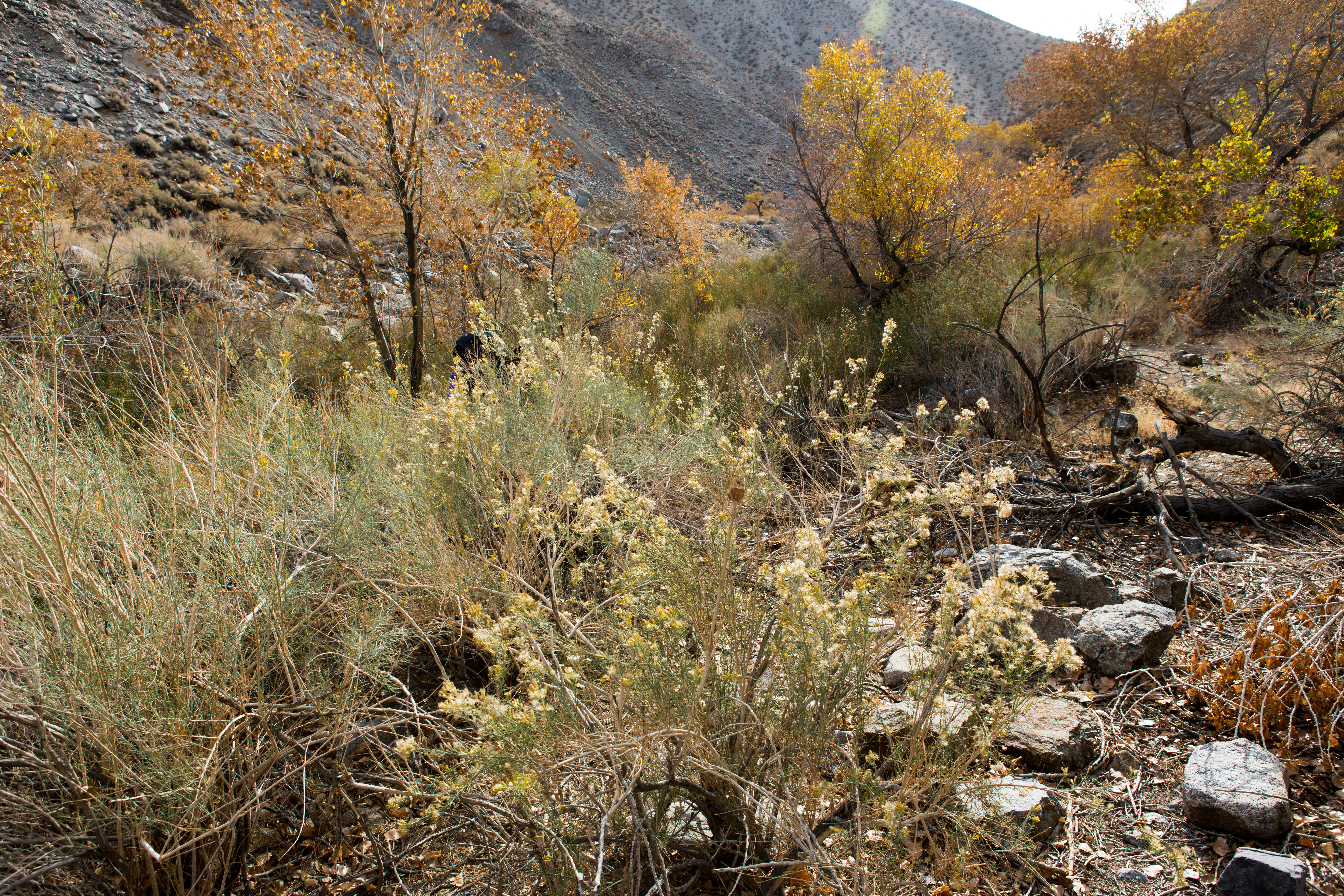
After being in the dry brush for so long, it was a visual shock to be among trees:

Water! I guess there was no need to pack in 11 liters, but better to have been safe than sorry!

You’ll keep heading up, traversing some pretty sandy and sketchy terrain, and eventually climb this relatively steep pass:

Over the top, down into a small valley, through a ton of horse shit, and up a small hump, you’ll reach the other side!

For the spring, look down toward the oasis, and head for the very top of it. It’s on the right edge in this photo. Once you head down, you’ll see a slight clearing, where you can actually reach the small stream.
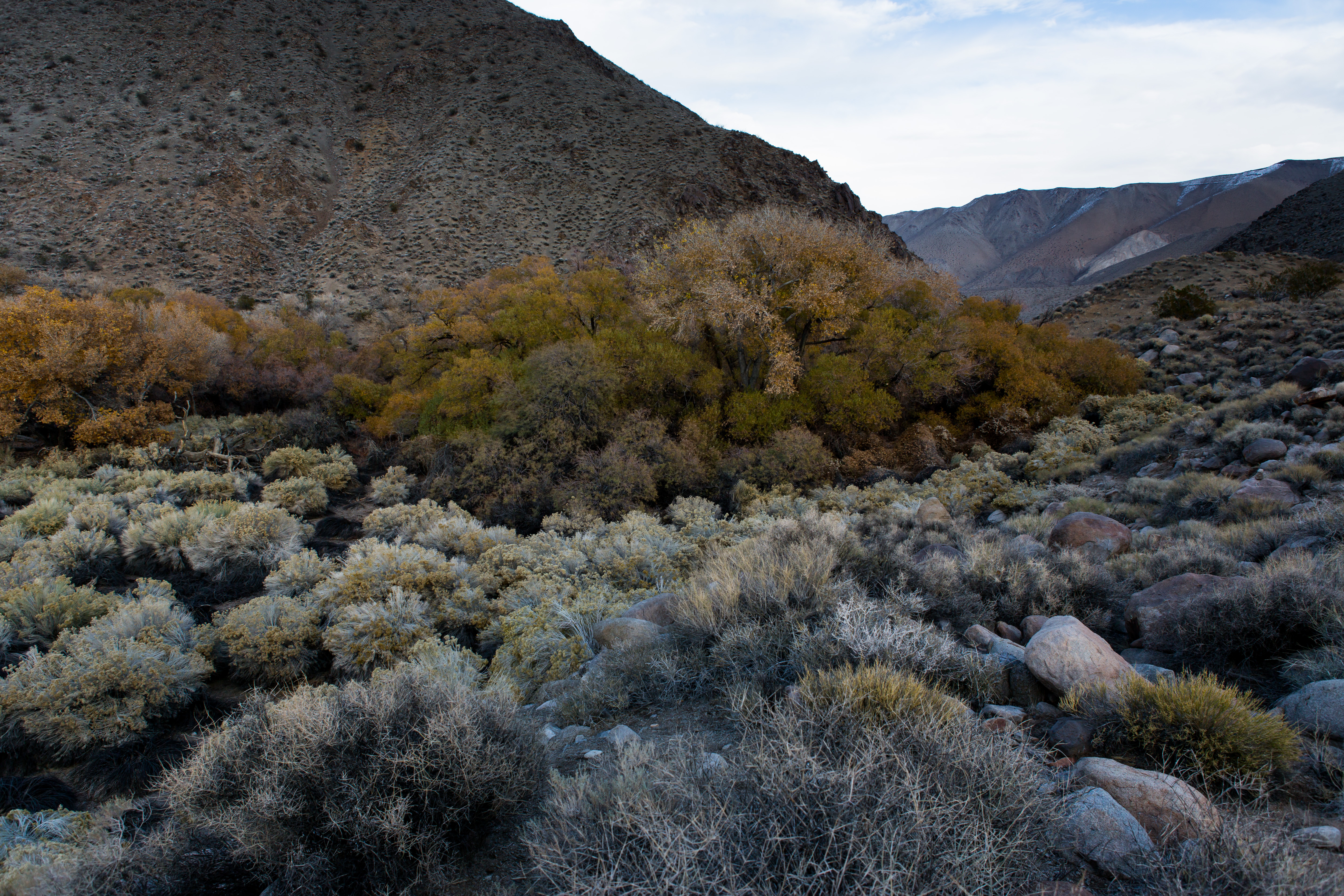
We rested here for a bit, then pushed forward into the large valley. We were a little confused about where to go, but really, just turn right in the first creekbed (or any creekbed). Once you’ve gained just a bit of elevation, it’s painfully obvious where the large long valley is. It’s so long in fact that it’s deceiving to the eyes. You feel like you can cross it in an hour, but it will take quite a bit longer…

We camped halfway up. We’d climbed to close to 4000ft by then, so by sunset, the temperature was already around 45, and it was close to or below freezing at night.

It was Thanksgiving, so we ate some freeze-dried turkey tetrazzini. Yum.

Next morning, gorgeous sunrise:

This next pass is the trickiest to hit, and pretty easy to get wrong. It’s the low point at the middle of the photo below. As tempting as it is, do not try to slowly climb and traverse; it turns out to be a lot easier to just hang low until you’re almost perpendicular to the pass, then go straight up the gully. Also, probably pretty obvious, but do not get tempted by just continuing up the valley that slightly curves left. When you see the end of the valley, hang right into this discreet pass.

When you reach the pass, it’ll look like this. Just go up any way you wish.

We started from around sea level, but at the top of this, we found snow!

Once you go over the crest, you’ll see a high valley in a sort of saddle shape. It’s a bit confusing where to go from here, but with some compass work, you’ll find that you essentially want to stay on the left-side hill of the saddle, and go over the ridge right in front of that hillock. Honestly, this was the trickiest part of the hike, and with “Dead Horse Canyon” directly to the right of you, we felt it was worth doing some careful orienteering to figure out where we were going.

Once you reach that second ridge, you’ll see what’s obviously the start of Marble canyon. It’s a very steep descent, so stay on the ridge as you go down. You’ll see a continuation of the ridge to the right. Definitely take it. You’ll need to do some brush scrambling near the bottom, but it most definitely beats just going straight down.

Skeletons!

You end up walking in a narrow canyon for quite a while. If you’re averse to narrow passageways or getting your ankles mercilessly cut up by shrubbery, this may not be the best hike for you. However, if you do get over those obstacles, you suddenly happen upon the entrance of Marble Canyon proper:

It was unbelievable.


After a few more miles of hiking on the narrow canyon trail, we saw a mini-steppe about twice the height of me, where ancient floods had carved a flat platform perfect for camping.

Next morning, after 2 more miles, we exited the canyon into the rough gravel that we started on. Another mile or two later, we hit the old sign that marked the crossroad we had hit 3 days ago to start our journey:

A few miles later, we spot Taiiiga! (Taiiiga==my car)

This was the most serene backpacking trip I’ve done to date. On the entire hike, we saw 3 people, one doing an intense hike the other direction, and the other two doing a day hike in as we were heading out. The vastness and grandeur of the semi-arid highland chaparral just cannot be expressed in words–you walk, step by step, and many shrubs and hours and skeletons and ancient dried-up rivulets later, you realize that the golden-blue pass you’re aiming for has only processed minutely closer.
This must have been what it was like when Earth was young.